

Coverage of ERS and JERS SAR Image over SIBERIA
A selection of images are presented for viewing, please search for images using the table or the mosaic image.
ERS Images
Search using the tabulated data.
Search using the interactive ERS image mosaic.
Search using the interactive JERS image mosaic.
![]() Information
Information
This site aims to keep track of ERS and JERS SAR products that are made available to the methodology teams. The processing of single look complex (SLC) data to amplitude and coherence scenes and delivery of these scenes to the methodology team can be visually interpreted by examining the images and associated attribute table (SAR cover table).
The development of the map will depend on information provided by the methodology teams to UWS or to SCEOS as part of the monthly methodology reporting forms. The information required will take the form of the attribute table.
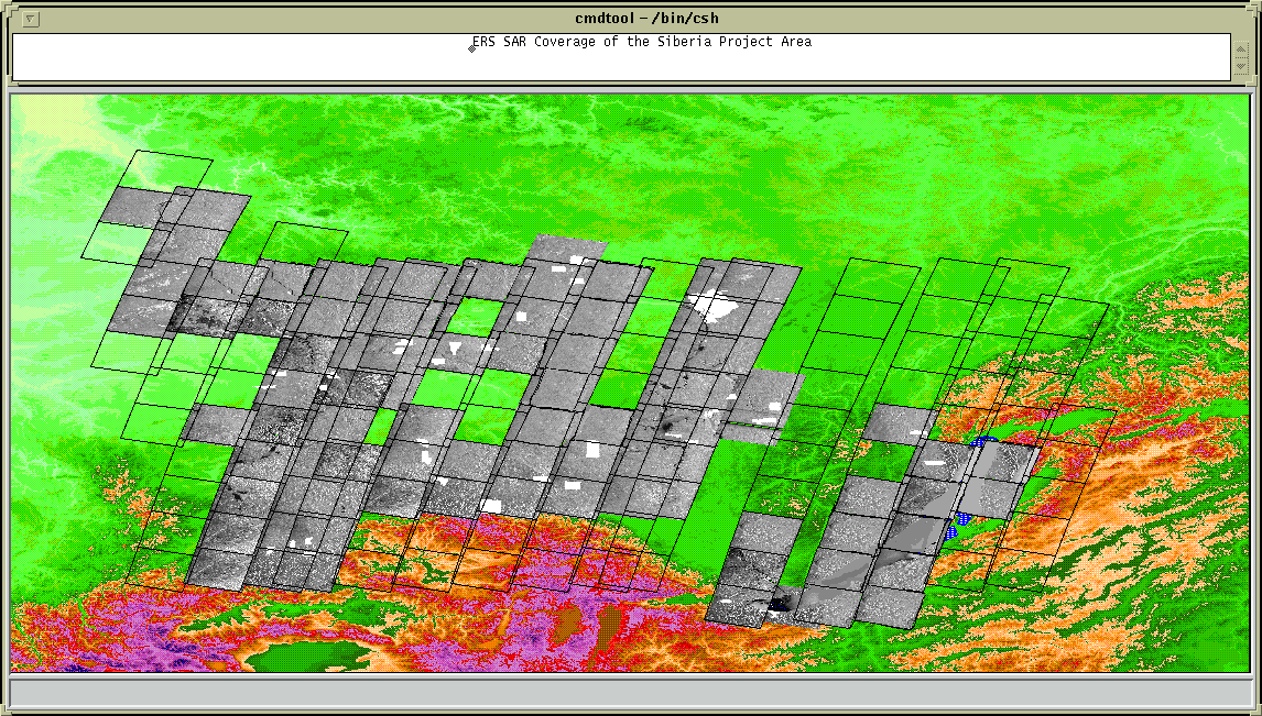
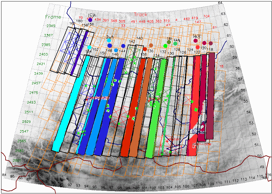
The data are superimposed on top of the Global 30 Arc Second Elevation Data Set which is available from the USGS. The SIBERIA project area has been approximately estimated to extend from 86 deg. E, 64 deg. N (top-left of image) to 116 deg. E, 50 deg. N (bottom-right of image). The DEM has been density sliced to enhance the topographic variation, the colour scheme ranges from light green (low lying) through browns, reds and purples. Lake Baikal is shown in blue.
Each acquisition, tandem or otherwise will be coarsely geo-corrected to geographic coordinates and plotted onto the DEM projection. Also shown on the images are the approximate location of the field test territories supplied by IIASA.